Staten Island: Then and NowFrom The Peopling of New York City
OverviewChanges are occurring all around us every day. We may not notice them all the time, but look back even a year ago, and you can see the differences. Sometimes we take these things for granted, not realizing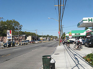
My research revolved around both numerical data and the memories of people who lived on Staten Island in the 50’s and 60’s. As for the information about the past decade, I tried to collect the views and opinions that different people, especially teenagers and young adults, have about Staten Island as it is right now. It is important to see what actual residents—both fifty years ago and today—think about Staten Island. Their impressions are what shape Staten Island’s personality.
Quick Facts
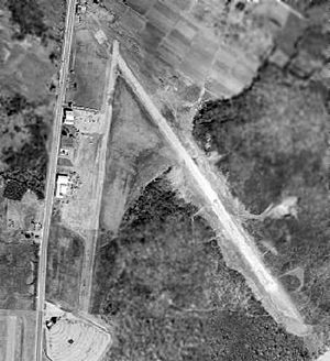
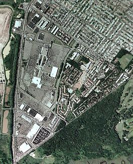
How Has Staten Island Changed?Some Visible ChangesRichmond Avenue
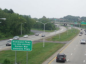
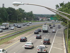
Highways
PopulationTo begin the comparison, I looked at the most basic, yet crucial, piece of information: population. Since the 2010 census has yet to be released, I had to use the numbers from the 2000 census, which indicated a population of 443,728, which at the time was only about 5.5% of the entire population of New York City. Fifty years prior, the population was a mere 191,555. In 1950, Staten Island accounted for less than 2% of New York City’s population. Staten Island is often times referred to as the “Forgotten Borough,” a title that is not far-fetched given our small population and isolated location. Of course, if you look at Staten Island compared to the rest of New York City, we seem almost infinitesimal, but if you look at the numbers from 1950 to 2000, our population has more than doubled in fifty years. This is one of the most defining changes on Staten Island, because there are so many causes and effects to look at. 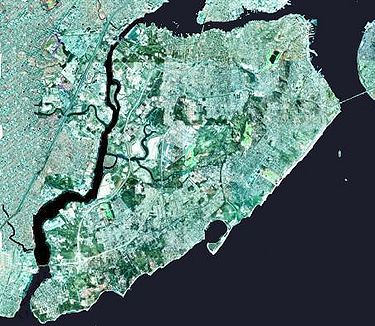 CausesOne major cause of this population increase is the building of the Verrazano-Narrows Bridge in 1964. In fact, from 1960 to 1970, Staten Island saw the greatest increase in population in a single decade, about 73,000. Before the bridge opened, the easiest way for Staten Islanders to reach the rest of the city was by ferry. The bridge made the other four boroughs much more accessible from Staten Island, and vice versa. It caused a great influx of people who sought to reside on Staten Island because it has a suburban feel to it yet is still a part of New York City. Plus, it is now a lot easier to get to, and it is a great place to raise a family. Also See: The Verrazano Bridge: The Link to Change and Over The Verrazano. EffectsBecause the population has doubled in number over the last fifty years, but Staten Island remained the same in terms of area, the level of congestion has increased. In 1950, Staten Island had a population density of 3,254 people per square mile, compared to 7,513 per square mile in 2000. After the opening of the Verrazano-Narrows Bridge, Staten Island had more people, had more cars, needed more housing and needed more roads. Despite having large amounts of undeveloped Greenland, the developed parts of the island were—and still are—extremely congested, a characteristic that many Staten Islanders are quick to point out. What’s interesting to note is that out of all five boroughs of New York City, Staten Island is the least dense in terms of population. When I asked a student what she thought about Staten Island, she questioned why Staten Island is made up of mostly houses, as opposed to apartment buildings often seen in the other four boroughs. This factor could add to the perception of congestion, along with the large amount of cars, small amount of roads and the fact that 38.4% of Staten Island’s land area is open space or unused/vacant land. Racial/Ethnic Make-upI interviewed my father, William Cella, who noted a significant change in the racial make-up of Staten Island. He said that when he was growing up, Staten Island was heavily made up of Italians, himself and his family included. As the years went by, he noticed that Staten Island was becoming much more racially diverse. Contrary to what he has noticed, today Staten Island is still 78% White, and Italians-Americans account for 38% of the total population of Staten Island. That’s still a huge amount in my opinion, but I also read that most of the non-white residents live on the North Shore, which is where my family resides. Perhaps in the northern areas, it seemed to be getting a lot more racially diverse, even though as a whole, Richmond County is predominantly White, and has the largest percentage of Italians of any other county in the United States. It seems that the changes in racial and ethnic make-up vary among the various sections of Staten Island. Opinions of ResidentsOver the course of my research, an interesting difference I noted was found in the opinions that residents have of the Island. When I asked my father, a resident for fifty years, his impression of Staten Island, he said, “It’s still a good place to live and to raise a family [and] it’s convenient to the city.” However, when I surveyed a group of ten students, ages ranging from 16 to 20, a majority of them had conflicting views. (Complete results of the survey can be seen here.) One student commented on how secluded and isolated it is from the rest of the city. More than one student mentioned how very little there is to do here, and that it’s a little on the boring side. My father, on the other hand, spoke about the different things he used to do for fun as a kid, playing games like stickball and “kick the can,” as well as baseball in the park. That may not seem like the most entertaining thing to some people, but the difference is that the children in the neighborhood used to make their own fun. They didn’t have computers and video games to keep them entertained, so they had to find other ways to have fun, and they did. Only two of the students actually said they liked Staten Island and enjoyed living here, while many were sort of lukewarm about it, saying things like, “It’s not a terrible place to live.” One student was alone in expressing the positives of living on Staten Island, commenting, “It's full of rich diversity and history, of which its residents rarely seem to appreciate.” His worlds exactly echo the types of responses I received from other younger residents. I think that is because Staten Island is home to a lot of adults who see it as a nice place to raise a family, but with little here in terms of entertainment, many younger residents don’t see the appeal.
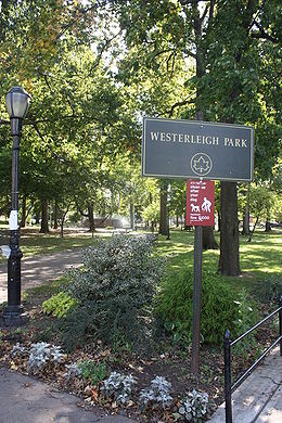 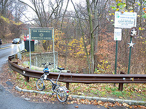 How Has Staten Island Remained the Same?Of course, not every aspect of Staten Island has significantly changed over the past half-century. Many organizations, such as the Staten Island Historical Society, strive to preserve the Island’s history, so sites like Historic Richmondtown and the Greenbelt have remained relatively the same over the past fifty years. My father also mentioned that many distinct neighborhoods that were considered “established” in the 50’s and 60’s such as Westerleigh, Port Richmond and Castleton Corners are pretty much the same in terms of houses, parks and roads. As far as I could tell from my research, Staten Island continues to be a great place for families and for people who are looking for the best of both worlds: a suburban environment while still being a part of New York City.
Wrapping Things UpThe general “Snapshot” of Staten Island has definitely changed over the past half-century. “Snapshot: 1950’s” shows a lot more green areas and woodland, a heavy Italian influence, no highways, no Verrazano-Narrows Bridge, a greater disconnection from the rest of New York City, and a much smaller population in terms of numbers and density. “Snapshot: 2000’s” shows greater amounts of housing and land development, a more racially diverse community, more roads (though some argue that there still aren’t enough), three different highways crisscrossing the Island, a bridge to connect us to Brooklyn and a population that has more than doubled in size. There are so many changes being made, even as we speak, that we might miss if we don’t stop to look at them and the impact they have on our lives as Staten Islanders. If these are the changes that occurred in just the past half-century, imagine what the future holds for us. Maybe if we notice the trends, we can accommodate our community for them. The population will continue to increase, so more roads will be needed to ease traffic congestion. Perhaps catering to the needs of the younger population—34% of the total are under the age of 24 —will help spark the appeal to stay here. Just being able to acknowledge the changes occurring around us can help make the future Staten Island an even better place. Sources
|