Brighton Beach
From Decoding New York
| Introduction |
| Brighton Beach |
| * Evolution |
| * What's Real |
| * Here v. There |
| * Economy |
| Crown Heights |
| * Evolution |
| * What's Real |
| * Here v. There |
| * Economy |
| Comparison |
| * Photo Gallery |
| * Sources
|
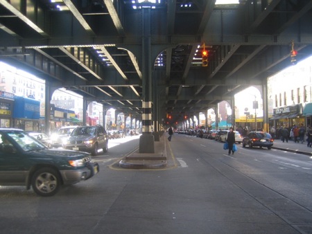
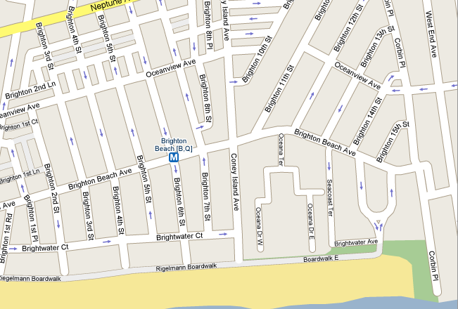
Brighton Beach is located at the Southern tip of Brooklyn in New York City, facing the ocean. It is bounded by Coney Island at Ocean Parkway to the west, affluent, but non-gated Manhattan Beach at Corbin Place to the east, Gravesend at Neptune Avenue to the north (at the Belt Parkway), and the Atlantic Ocean to the south (at the Riegelmann Boardwalk/beachfront). Brighton Beach is also bounded by Corbin Place to the East and Ocean Parkway to the West. Within these four "walls" lies everything that represents Brighton Beach and makes it significant to its population. Along Brighton Beach Avenue, the signature Q train hovers above people's heads as they shop and socialize in the streets.
Various stores and restaurants makes Brighton Beach an ideal family location during the day and nightclubs make Brighton Beach entertaining for a night life experience as well. Fifteen Brighton Beach streets are filled with six-story red-brick buildings, housing a large population. Nearby parks, libraries and schools make the neighborhood a great place to raise a family. Its proximity to the beach and transportation only adds to the pleasantness of Brighton Beach and its over-stocked shopping area adds to its convenience. Based on the majority of stores and businesses and the language they are in, it is clear that the dominant language in the neighborhood and the Russian immigrants come from various places in the former Soviet Union. "Little Russia by the Sea" is a recreation of an old life in a new place, with a very different passport.