November 3, 2012, Saturday, 307

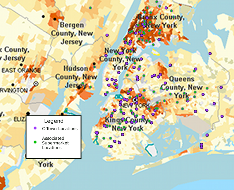
File:Dominicans vs C-Town vs Associated.png

From From the Island to the City: Dominican Communities in New York City
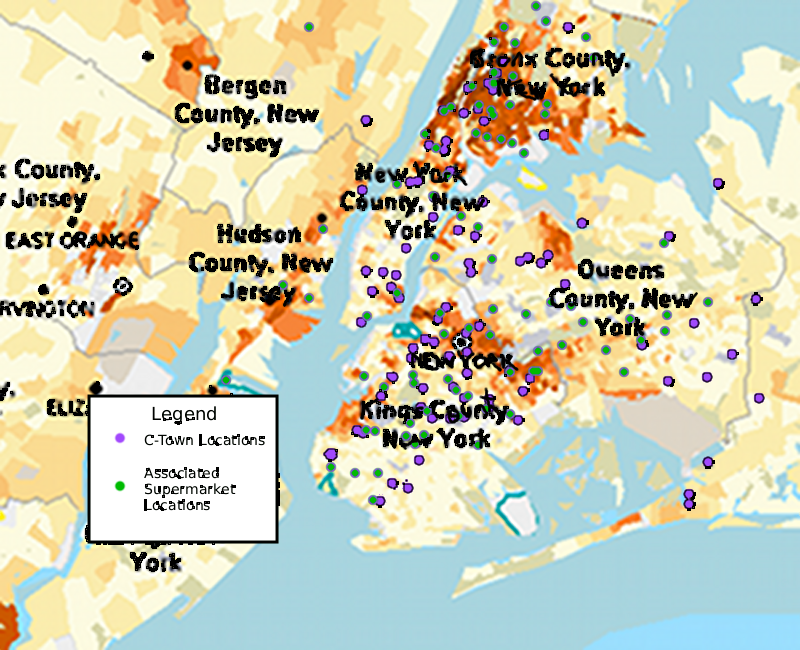
Jump to: navigation, search

This is a map I created to show the C-town and Associated Supermarket Locations around New York City. I placed the locations on the map shown in the Demographics section to show the correlation between these businesses, which are primarily Dominican owned, and the Dominican populations in the areas.

File history

Click on a date/time to view the file as it appeared at that time.

(Latest | Earliest) View (newer 50) (older 50) (20 | 50 | 100 | 250 | 500)
Date/TimeThumbnailDimensionsUserComment
current05:53, 9 May 2010Thumbnail for version as of 05:53, 9 May 2010800×650 (737 KB)Jocana (Talk | contribs) (The wording is clearer and the file is larger)
05:26, 27 April 2010Thumbnail for version as of 05:26, 27 April 2010500×406 (382 KB)Jocana (Talk | contribs) (This is a map I created to show the C-town and Associated Supermarket Locations around New York City. I placed the locations on the map shown in the Demographics section to show the correlation between these businesses, which are primarily Dominican owned)
05:19, 27 April 2010Thumbnail for version as of 05:19, 27 April 2010800×650 (747 KB)Jocana (Talk | contribs) (This is a map I created to show the C-town and Associated Supermarket Locations around New York City. I placed the locations on the map shown in the Demographics section to show the correlation between these businesses, which are primarily Dominican owne)
(Latest | Earliest) View (newer 50) (older 50) (20 | 50 | 100 | 250 | 500)

The following page links to this file: