|
|
Upper East Side: ContextFrom The Peopling of New York CityClick Here to Return to The Upper East Side The Upper East Side is the Manhattan Board 8. It is from E 59th street to E 96th street, from Fifth Avenue to the East River. [1]
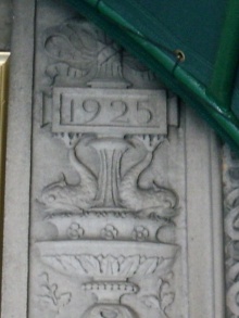
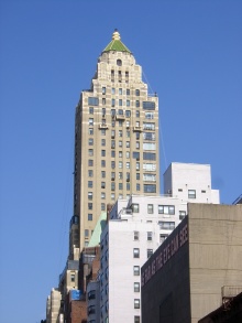
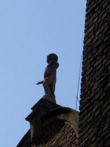
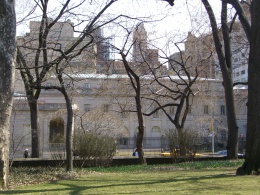
Pictures
MapsDemographicsAll demographics are drawn from here [2] Years: 1850, 1870, 1900, 1920, 1950 Total Population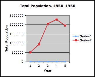 Year 1= 1850 (Population: 515, 547) Year 2= 1870 (Population: 942,292) Year 3= 1900 (Population: 2,050,600) Year 4= 1920 (Population: 2,284,103) Year 5= 1950 (Population: 1,960,101) As you can see from the graph, the population has changed signficantly over the years from 1850 to 1950. Central Park was first opened temporarily in 1857. Since sometime around that time period, the population has increased. There was a drastic increase in population from the year 1870 to 1900, from having 942,292 people to having 2,050,600 people. That's probably the time when the Park became open and well known throughout New York. However, there was a decrease in total population from the year 1920 to 1950. This was most likely due to the Great Depression which forced many people to move out of the New York County. Race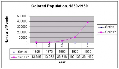 The percentage of colored people/negroes (according to the Census) remained relatively low and stable between the periods 1850 to 1920. In 1850, approximately 3% of the the total population were colored people. In 1870, approximately 1% of the total population were colored people. In 1900, approximately 2% of the total population were colored people or negro. In 1920, approximately 5% of the total population were negroes. Over this 70 year time period, the colored population did not change much. There was a drastic increase in the colored population from 1920 to 1950. Approximately 20% of the total population were negroes. --> Percentages are derived from totaling the number of colored people/negroes and then dividing that number by the total population. In 1850, the population was separated into two groups. One only belonged to the colored group or the white group. However, as time progresses, people from other countries began to move in and New York County's diversity increased. People from countries such as Austria, China, France, Germany, etc. FamiliesAs people began to move into the Upper East Side, they gradually plant their seeds by starting to formulate families. There were no records found on the total number of families in 1850 and 1870. However, in 1900, we start to see the number of families recorded on the census. In 1900, there were 433,953 total families out of which 425,461 were private families. In 1920, there were 525,154 families and in 1950, there were 496,490. We can see some correlation between to total number of families and the total population. There was an increase in families between 1900 and 1920 along with an increase in population. There was a decrease in families between 1920 and 1950, similar to the total population record. Once again, this might be caused by the Great Depression, where many people flee from the New York County in hope for a better life. EmploymentThe types of employment from 1850 to 1920 were mainly agricultural or manufactural-based. People either worked on the fields and farmlands or in factories. In the 1950 Census, the producers made the Census more detailed. They asked for people's job specifications. There were jobs other than agricultural or manufactural-based. There were Operatives and Kindred Workers, Craftsmen, Foremen, and Kindred Workers, Sales Workers, Clerical and Kindred Workers, Managers, Officials, and Proprietors, Private Household Workers, Laborers (Except Farm and Mine), Farm Laborers (Except Unpaid and Farm Foremen), Farm Laborers, Unpaid Family Workers, Service Workers (Except Private Household), Farmers and Farm Managers, Government Workers, Professional, Technical and Kindred Workers, etc. Not only was there a diverse working fied, women took roles in these professions too. The total number of employed women is 347,898 in 1950. The total number of employed men is 536,464 in 1950. There were approximately 40% of women being employed. In summary, women gradually began taking active roles in society. EducationMore people became enrolled in the educational system. I find it interesting how in 1850, only about 1.3% of pupils manage to go to college after receiving a lower education. The majority of the students entered the work force at an early age and rejected the college education.
A Glance to the PastIn 1811, the whole Manhattan island was divided and sold in lots under the Commissioners Plan for New York, but the area of Upper East Side remained undeveloped and barely settled. Only the area around Third to Fifth Avenue and 65th street to 69th street was tracted out as Hamilton Square and was intended to be estates. [6]
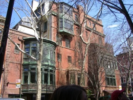
 After the Irish potato famine and the Revolution of 1848, large numbers of Irish and German immigrants moved in to the city. Overpopulation caused great expansion of the city, pushing the settlements upward. The increasing density led to the demand for and then the building of Central Park. The park was designed to relieve some of the pressure of the crowded city and to provide more jobs for New Yorkers during the Panic of 1857. According to History of Real Estate, property above 59th street rose over 200% between 1868 and 1873. Rowhouses also began being built on Madison Avenue, close to the horsecar lines. But when the Panic of 1873 struck, land values dropped drastically. [8]
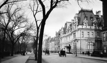 "New York City: upper Fifth Avenue." Online Photograph. Encyclopædia Britannica Online. 5 May 2008 <http://www.britannica.com/eb/art-96296>. After WWI, living in apartment buildings became more fashionable. Coupled with the rising land costs and the other economic difficulties included in maintaining a private residence, many wealthy sold their houses and moved into luxurious apartments in the same area. In many cases these mansions were left abandoned. However, the neighborhood remained wealthy and luxurious. [12]
References
|
