|
|
File:Land use map 1ST floor copy 2.jpgFrom The Peopling of New York City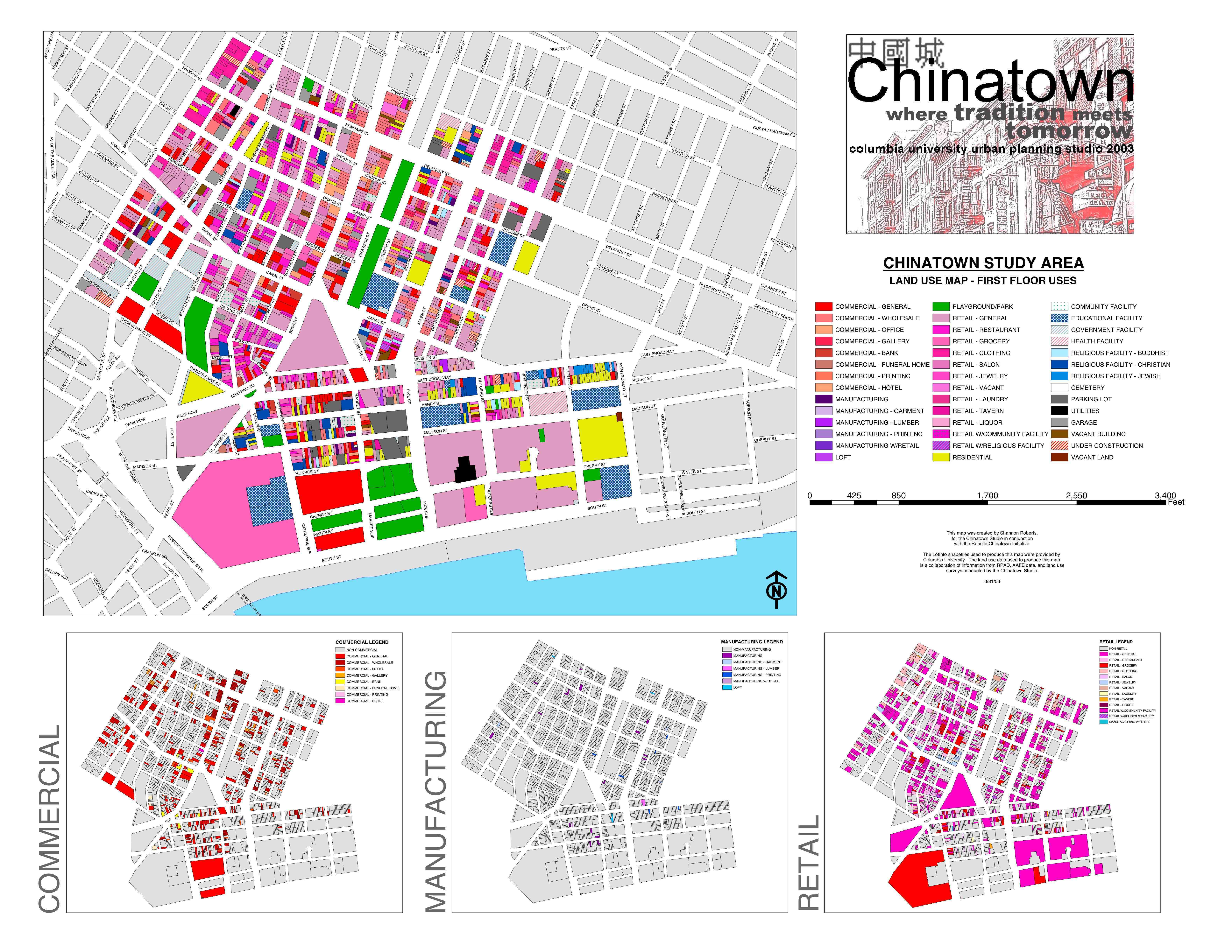 Size of this preview: 310 × 240 pixels Full resolution (6,334 × 4,896 pixels, file size: 1.93 MB, MIME type: image/jpeg) Breakdown of land usage and urban planning of Chinatown. The different buildings and how they are being used. File historyClick on a date/time to view the file as it appeared at that time.
File linksThe following page links to this file: |


